Cold Front Approaching: What to Expect in the Rio Grande Valley
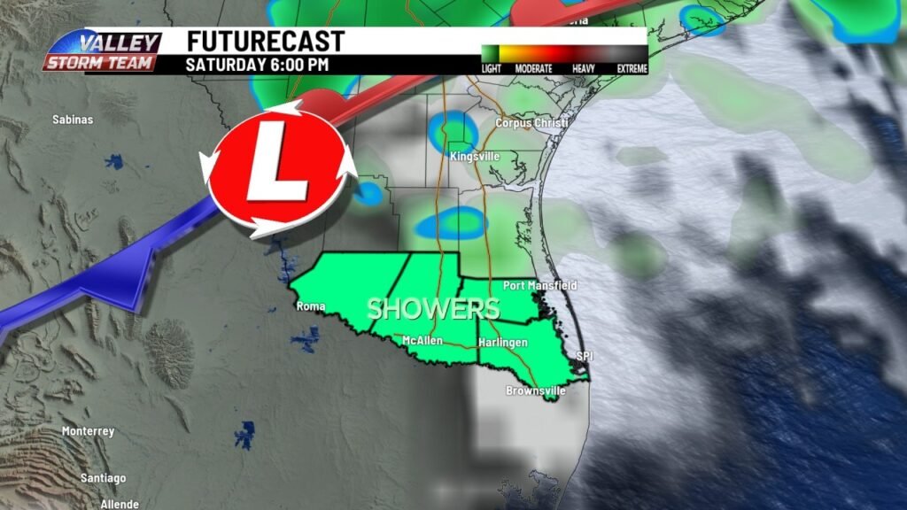
HARLINGEN, Texas — A moderate cold front is set to make its way through the Valley on Saturday night, bringing the possibility of rain and thunderstorms. This article delves into the specifics of the upcoming weather changes, including expected precipitation, storm threats, and aftereffects.
An Overview of the Cold Front
As this weather system moves in after 6 p.m., residents can anticipate at least a 40% chance of rain and thunderstorms. While the rain is welcome, it is unlikely to provide significant relief from the ongoing dry conditions in the Valley.
Timing of the Rainfall
The likelihood of rain will begin to increase as the night unfolds, peaking around midnight. This happens as the cold front, a leading edge of cooler, drier air, sweeps southward across the region.
Severe Weather Alerts and Risks
According to the Storm Prediction Center, most of the Rio Grande Valley, particularly areas east of Mission, is currently categorized under the lowest threat level for severe weather. However, as the cold front interacts with the warm, moist air in the atmosphere, the potential exists for a few robust storms.
Storm Characteristics
The primary threats from these potential severe thunderstorms include:
- Strong gusty winds
- Frequent lightning
- Brief, heavy downpours
- Small hail
Residents are encouraged to stay informed about local weather updates to ensure safety. For more real-time information, check the National Weather Service.
The Aftermath: Cooler and Drier Conditions
The silver lining of this storm system is that cleared skies will follow. On Sunday, a north wind will introduce milder, drier air across Deep South Texas. This change will not only create a more comfortable atmosphere but also enhance outdoor activities for residents in the region.
Time Change Alert
Additionally, don’t forget that Saturday night marks the end of Daylight Saving Time. Residents will enjoy an extra hour of sleep as they set their clocks back one hour, transitioning back to standard time.
Conclusion
In summary, the impending cold front will usher in the potential for rain and thunderstorms in the Rio Grande Valley. Although the storm may not deliver substantial rainfall, it does bring along the chance of gusty winds and additional weather advisories. Following this weather event, expect a refreshing shift toward cooler and dryer conditions, just in time for an extra hour’s rest. Stay tuned for further updates and ensure your safety during this transitional phase.
For ongoing weather updates and safety tips, visit Weather.com.


