Fall Weather Alert for Texas: Storms, Temperature Changes, and More
As we welcome the first day of fall, the weather across Texas is set to undergo significant changes. This week, residents can expect a shift towards a stormier pattern, with numerous opportunities for thunderstorms and a potential break from the relentless summer heat. A cold front is approaching, promising cooler temperatures and the possibility of severe weather.
Monday: Transition from Morning Storms to Evening Showers
On Monday, North Texas will experience morning thunderstorms that will gradually subside by early afternoon. Although some light precipitation may linger in Northeast Texas, the primary storm activity will diminish. Later in the day, isolated storms may develop in the Texas Panhandle and West Texas, although the risk for severe weather remains low.
Tuesday to Wednesday: Increased Potential for Severe Weather
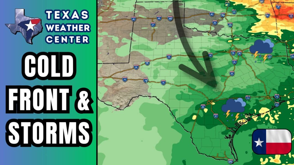
The most active weather phase is expected from Tuesday afternoon to Wednesday morning as a cold front sweeps into the state. Focus areas include:
- Regions Affected: Big Country, Concho Valley, North Texas, Texoma, Northeast Texas, and Ark-La-Tex.
- Storm Threats: Wind gusts exceeding 70 mph, large hail, torrential rain, and frequent lightning strikes are anticipated.
- Tornado Risk: While the risk remains low, it’s not entirely ruled out.
- Timing of Events: Storms will start scattered on Tuesday afternoon, intensifying through the evening and overnight into Wednesday morning.
Localized flash flooding may also occur in areas that receive multiple storm cells, warranting caution.
Wednesday: Cold Front Advances South
By Wednesday, the cold front will progress further south, impacting South and Southeast Texas. The storm chances will extend into regions such as the Edwards Plateau, Rio Grande Plains, and Coastal Bend. Although widespread severe weather isn’t expected, isolated storms could still pose risks of strong winds, hail, and lightning.
Looking Ahead: Weather Trends and Tropical Activity
As we glance toward the days following the storm activity, weather patterns will stabilize. Expect a return to lower humidity and more seasonal temperatures late in the week.
In the tropics, Hurricane Gabrielle has rapidly intensified southeast of Bermuda but poses no immediate threat to the U.S. coast. Furthermore, two additional systems have emerged east of the Caribbean that may develop, with one potentially tracking closer to the Bahamas. Fortunately, no threats to Texas or the Gulf Coast are on the horizon.
Key Takeaways
- Monday: Morning storms are expected to fade, with possible evening showers.
- Tuesday to Wednesday: The highest chance for severe storms statewide is anticipated.
- Wednesday Night to Thursday: Storm activity will shift southward with the advancing cold front.
- Late Week: A return to lower humidity and comfortable temperatures is expected.
Stay Weather Aware
Given the volatile weather conditions this week, it’s crucial to stay informed. Consider downloading the Texas Storm Chasers mobile app for interactive radar, live severe weather updates, and daily weather roundups.
By preparing for potential severe weather and staying engaged with updates, Texans can navigate this fall transition safely and efficiently.


