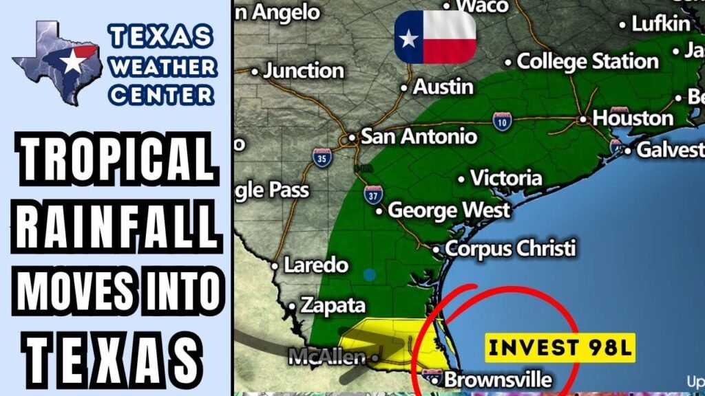
Tropical Disturbance Brings Rain and Weather Alerts to Rio Grande Valley
As a tropical disturbance makes landfall in South Texas and northern Mexico, the Rio Grande Valley is experiencing significant rainfall. While this system is not expected to strengthen into a tropical depression or storm, residents should remain cautious, particularly regarding hazardous rip currents expected along the Texas Gulf Coast this weekend.
Weather Alerts for South Texas
Today, residents in the Rio Grande Valley and Deep South Texas should be prepared for isolated to scattered flash flooding. Farther north, areas like the coastal plains of Southeast Texas and the Brazos Valley may encounter thunderstorms, which can produce locally heavy rainfall, dangerous cloud-to-ground lightning, and gusty winds.
Continuing Rains Tonight
During the evening, a few showers are anticipated across South Central Texas and the Hill Country. Forecasts indicate the possibility of heavier rain in these areas. While conditions will be monitored closely for any significant developments, expect to see sporadic showers and thunderstorms.
Saturday Forecast: Pop-Up Thunderstorms
As we transition into Saturday, pop-up thunderstorms are likely during the peak daytime heating hours in the Rio Grande Valley and surrounding areas. Meanwhile, in far West Texas and the El Paso borderland, thunderstorms may also bring locally heavy rainfall and increased winds, creating ideal conditions for street flooding.
Upcoming Week: Weather Patterns to Watch
Looking ahead into next week, an upper-level heat dome accompanied by a high-pressure system is expected to settle over the southwestern United States. This setup will initiate a weak northerly flow, boosting the chances for pop-up showers and thunderstorms, particularly across western, eastern, and southern Texas. The greatest probability of precipitation will occur during peak afternoon heating.
Thunderstorm Complexes from the North
Starting Wednesday, meteorologists will closely monitor areas north of Texas. Thunderstorm complexes migrating southward could impact the state due to the weak northerly flow aloft. Meanwhile, high temperatures typical of August will persist, likely hovering in the 90s and even reaching triple digits. As the heat dome gradually shifts west, a slight decrease in these elevated temperatures may become noticeable.
Atlantic Update: Hurricane Aaron
In the open Atlantic, Hurricane Aaron is currently traveling west-northwest and is on track to pass north of Puerto Rico over the weekend. Forecasts indicate that as the storm progresses into next week, it will take a northern turn, positioning it east of the United States and west of Bermuda. As a result, residents along the East Coast should prepare for dangerous rip currents and heightened wave action.
Stay Informed
For real-time weather updates, keep track of local conditions with our free interactive weather radar. It’s essential to remain informed as weather conditions can change rapidly, ensuring you and your loved ones stay safe during stormy periods.
By staying vigilant and informed, residents of the Rio Grande Valley and surrounding regions can navigate the weather challenges posed by this tropical disturbance and maintain safety throughout changing conditions.


