Unseasonal Heat in Harlingen Set to Shift with Cold Front: What to Expect
HARLINGEN, Texas — October has proven warmer than usual in the Rio Grande Valley, with temperatures consistently soaring into the upper 90s. This unusual heat is expected to give way to a significant weather shift later today as a robust cold front moves into the area.
Impact of the Cold Front
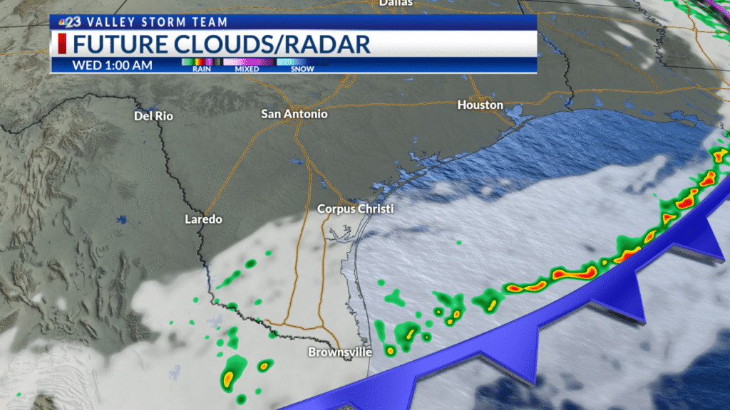
As of now, this cold front can be found in far northwest Texas, moving southward throughout the day. This weather pattern is set to bring multiple changes to the Valley, impacting temperatures, wind conditions, and rain potential.
Temperature Changes on the Horizon
Following the arrival of the cold front, residents can anticipate a sharp drop in temperatures. Wednesday morning will start near average, with readings in the low 60s. Expect afternoon highs to peak between the upper 70s and low 80s. This cooler weather will continue into Thursday and Friday mornings, where overnight lows could dip into the 50s—marking the season’s first significant chill since April 2025. By Thursday afternoon, highs will again reach the upper 70s, while Halloween sees below-average temperatures, likely hitting the low 80s. Normal seasonal weather should return for the weekend, coinciding with Daylight Saving Time.
Wind Conditions: A Strong Northern Flow
The cold front will also usher in a significant shift in wind patterns. Expect robust north winds, howling at 15 to 25 mph, with gusts reaching up to 40 mph, especially early Wednesday morning. Fortunately, these strong winds will begin to taper off as the day progresses, allowing for a calmer atmosphere later on.

Rain Possibilities: Isolated Showers Anticipated
While the primary function of this cold front is to bring cooler temperatures and stronger winds, there is also a chance for isolated showers tonight. A line of showers and thunderstorms is expected to develop but will predominantly affect coastal areas. Rain coverage is currently projected to be around 20%, with a higher concentration near the coast, diminishing rapidly as you head inland.

Fire Risk Escalates After the Cold Front
Once the cold front passes, a significantly cooler and drier airmass will settle over the region. Dew points are predicted to drop considerably into the 20s. This combination of strong winds, low humidity, and dry air raises the fire risk for the area. As a precaution, a Fire Weather Watch has been issued for all four counties within the DMA. It is vital for farmers, ranchers, and residents to refrain from any activities that could spark a fire, as they could spread quickly and become challenging to control.

Coastal Conditions: Navigating Hazardous Waters
Beachgoers should be mindful of the hazardous conditions resulting from the strong winds. Increased surf heights and rip currents are predicted for Wednesday and Thursday, potentially triggering high surf advisories. It’s essential to stay vigilant and adhere to safety guidelines while enjoying coastal activities.
Conclusion
As the Rio Grande Valley transitions from unseasonably warm conditions to a cooler, windier atmosphere, it’s essential to stay informed. Regular updates from the Valley Storm Team will provide the latest developments on weather conditions.
For more information on weather alerts and safety precautions, check official resources such as the National Weather Service and local news outlets to stay updated as conditions develop.


