Current Weather Patterns in New Mexico: A Detailed Forecast
New Mexico is experiencing a mix of weather conditions as we transition into fall, particularly characterized by somewhat humid air stretching across the Eastern and Northern parts of the state. Areas spanning from the Southern Rio Grande Valley to the Four Corners and the Northern Mountains are witnessing little to no rainfall. This pattern is marked by gusty east-gap winds in far-eastern regions, while central and western areas remain relatively tranquil. Notably, patchy fog is beginning to develop in the northern valley floors and far-eastern districts of New Mexico.
Temperature Variations Across the Region
As we observe temperatures across the state, northern mountain peaks and the far-northern valley floors are contending with around-freezing conditions. In contrast, most of New Mexico is waking up to milder temperatures, generally ranging from the upper 40s to the 60s, with some southern areas even beginning the day in the 70s. This temperature variation is typical for the initial days of fall, offering residents a brief reprieve from the summer heat.
An Insight into the Atmospheric Conditions
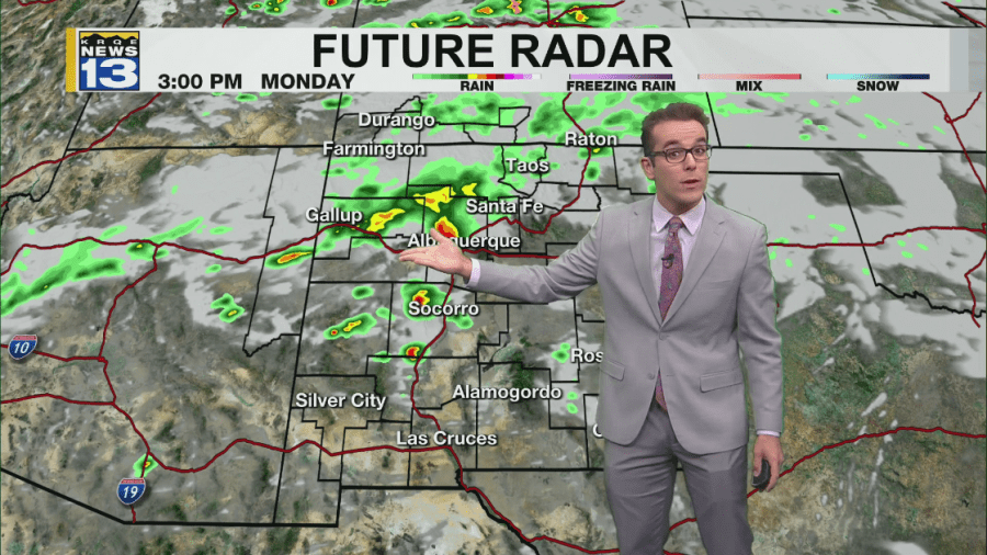
Westerly upper-level winds are playing a crucial role in the weather dynamics of New Mexico, infusing the region with upper-level moisture. This moisture is being influenced by the jet stream, which presently lies to the north of the state. Throughout today, we can expect a few rounds of monsoonal thunderstorms to develop in mountainous regions, extending into parts of the Rio Grande Valley and the East Plains. While flash flooding remains unlikely, stronger storms may produce small hail, accompanied by gusty outflow winds.
Sunshine and Rising Temperatures
Before the anticipated rainfall, residents can expect ample sunshine, causing afternoon temperatures to soar above seasonal averages. High temperatures are poised to reach the upper 70s and 80s in many areas. However, in the elevated northern regions, temperatures may stay in the upper 60s, while southern-central to southeastern locales are expected to experience substantially warmer weather, with highs touching the 90s.
Moisture Movement and Future Storms
Moisture levels are beginning to shift gradually towards the east at the surface. The prevailing pattern alternates between muggy mornings in eastern New Mexico and breezy easterly winds, which transition into southwesterly drier winds by afternoon. This pattern encourages storm development in eastern districts. A low-pressure system situated well off to the northeast may draw additional upper-level moisture closer to the surface in the upcoming days, particularly in Eastern New Mexico. This influx of moisture—coupled with existing upper-level units from the west—may facilitate the formation of isolated storms later this week, potentially resulting in a drop in temperatures for some regions.
Conclusion: What Lies Ahead
In summary, New Mexico’s current weather patterns reflect the dynamic changes typical for this transitional season. From humidity levels to temperature variations and the potential for thunderstorms, residents can anticipate an engaging and ever-evolving meteorological landscape. For continuous updates regarding the weather, including forecasts and detailed reports, be sure to visit KRQE NEWS 13 for the latest news, weather, sports, and streaming video.
This forecast serves as a comprehensive guide to understanding the current weather conditions in New Mexico while providing essential insights into what to expect in the coming days. Stay informed and prepared by keeping an eye on local weather changes!


