Increasing Chance of Tropical Storm Development Along Texas Gulf Coast: What to Expect
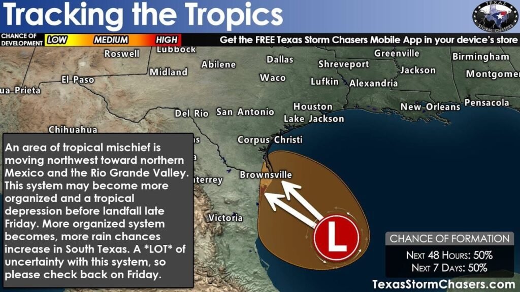
The National Hurricane Center has recently raised the probability of tropical activity impacting the lower Texas Gulf Coast. Invest 98L now carries an equal likelihood of evolving into either a tropical depression or a weak tropical storm before it reaches the Texas-Mexico border tomorrow evening. Regardless of its classification, the primary concerns surrounding this system will focus on heavy rainfall and the potential for localized flooding.
Understanding Invest 98L
While the overall forecast is still plagued by uncertainty, it is noteworthy that most weather models are not suggesting significant development for this system. However, a recent analysis of satellite imagery indicates some improvement in its structure. Although the hurricane hunters evaluated the storm and found it poorly organized, it appears to consist mainly of a cluster of thunderstorms. Favorable sea surface temperatures and minimal wind shear could increase the chances of this system becoming more organized as it heads west toward the Rio Grande Valley.
Current Threats Associated with Invest 98L
Even if Invest 98L does see some development, the risk of severe coastal flooding and damaging winds remains low. However, forecasters are warning residents along the Texas Gulf Coast of dangerous rip currents expected this weekend.
Flash flood outlook for South Texas indicating varying flood risk levels along coastal areas due to the approach of Invest 98L.
Rainfall and Flooding Risks
As Invest 98L approaches, the Texas Gulf Coast can anticipate scattered to numerous thunderstorms beginning Friday, extending into neighboring inland areas. The most considerable rainfall impact will be felt along the lower Texas Gulf Coast and in the Rio Grande Valley. This heightened risk will continue into Saturday morning, with storms potentially producing gusty winds, dangerous cloud-to-ground lightning, and rainfall rates reaching up to four inches per hour due to extremely high moisture levels pushing inland from the Gulf.
Tornado Potential and Isolated Flooding
The risk of brief tornadoes cannot be dismissed, particularly in areas like McAllen and Brownsville. Isolated flooding remains a pressing concern, especially for regions along the Rio Grande Valley.
What to Expect Over the Weekend
If the system were to organize more significantly, the potential for heavier rainfall in Deep South Texas would rise on Friday night. The amount of rainfall on Saturday will largely depend on the system’s evolution. Should it remain disorganized, areas from the Hill Country and Brazos Valley through Southeast Texas and the Golden Triangle could only experience scattered showers and storms.
Given the low confidence associated with this forecast, residents and visitors are encouraged to stay updated on the situation as conditions evolve. For the latest updates on this storm, check reliable sources such as the National Hurricane Center for real-time information.
Conclusion
The situation surrounding Invest 98L remains fluid and unpredictable. Authorities and weather experts advise residents to remain vigilant and prepare for the possibility of inclement weather, particularly in coastal regions. With heavy rainfall and localized flooding on the horizon, informed preparation will be key to navigating the challenges posed by this developing tropical system.


